ISOSTACY THEORY
About the Theorist
Sir George Biddell Airy (1801-1892, Greenwich, London), English mathematician who was astronomer royal from 1835 to 1881. Airy graduated from Trinity College, Cambridge, in 1823. He became Lucasian professor of mathematics at Cambridge in 1826 and Plumian professor of astronomy and director of the Cambridge observatory in 1828. In 1835 he was appointed the seventh astronomer royal, i.e., director of the Royal Greenwich Observatory, a post he would hold for more than 45 years.

Sir George Biddell Airy
The word isostacy is a Greek word means “equal standing”
The theory postulates that the continents and their major features are maintained in a sort of equilibrium; whereby the large portions of the Earth’s crust are floating on a denser underlying layer called mantle.

- Thus the areas of less dense rock rise topographically as continents and mountains, their movement is compensated for by a similar downwards penetration of this less dense rock into sima
- Hence the lithosphere has highland and lowland due to the variation in density of the materials and gravity, so lowland have denser materials than highland.
- Regardless the density variation, the Earth maintain its balance, any disturbance on the earth’s crust cause movement of the molten materials (Asthenosphere) in a mantle to different direction for the sake of bringing back equilibrium

The concept of Sir George Airy (hypothesis proposed in 1855)
- According to Airy, the inner parts of the mountains are not hollow; rather the excess weight is compensated by the lighter materials below.
- According to him the crust of relatively lighter material is floating in the substratum of dense material.
- Therefore, the continents which are made of lighter sial are floating over the sub-stratum which is built of the denser sima.
- Thus, Himalaya is also floating in the denser glassy magma.
- He suggested that the lighter sial of the Himalaya is floating over the denser material of sima lying underneath.
- Not only this, but the Himalaya is floating in the denser magma with their maximum portion sunk in magma in the same way as aboat floats in water with its maximum parts sunk in the water.
The movement are of two types;
- Vertical and Lateral movement
- Vertical movement
involves upward and downward, hence it cause either uplift or sagging of the earth’s crust respectively.
- Highland are center of denudation while lowland is the center of aggregation.
- Thus when the highlands are worn down there occurs land uplift as a result of upward movement of mantle materials caused by reduction in weight on the earth’s surface.
- As well as when ice melt leads to crust uplift because of reduction in weight while Forming deposition on lowland part of the continents.
Evidence of Isostatic movement
- The depression of the crust in the northern part of America and Europe was due to the weight of ice sheets of vast thickness during the ice age.
- The slowly rising of crust due to ice sheet melting, in the former beaches that occur around the coast of Scandinavia. Now lie from 8m to 30m above the present day beaches.
- Submergence of forests on the shores of Britain.
The continental shelf around Antarctica is covered by water to a depth of about 750m compared with 180m around the continents.
- Presence of rias and estuaries between coastal lands of Gambia and Sierra-Leone.
A ria is a coastal inlet formed by the partial submergence of an unglaciated river valley. It is a drowned river valley that remains open to the sea. Typically, rias have a dendritic, treelike outline although they can be straight and without significant branches.

Ria
Estuary
An estuary is a partially enclosed coastal body of brackish water with one or more rivers or streams flowing into it, and with a free connection to the open sea.

Estuary
Effects of Isostatic Movement
- Formation of faulting leading to the formation of Grabens, Horsts and tilted block.
- Creation of folding leading to the formation of various folds as well as fold mountain.
- Formation of Earthquakes with the associated effects like faulting subsidence and uplift.
- Volcanic eruption forming different volcanic features(volcanoes).
Critique/Challenges of the Theory
- The theory failed to explain the formation of depositional features which are seen to appear above the sea water level.
- The theory has more generalized that is it has over looked. It has not pointed out which mountains have roots
- Is it true that, all mountains maintain their heights in the same way as postulated by theory ? Consider the case of residual mountains which have been formed by denudation.
Importance of Isostacy Theory
- It provide an understanding on the dynamic state of the earth’s crust, that the Earth’s crust is not static it is dynamic as it tends to balance itself after some disturbance and the influence of gravitational force.
- It paves a way to understand theories such as plate tectonic and continental drift, through the idea that crust floats like ice berg on the ocean.
- It helps understanding of how various landforms were formed e.g fold mountain and garbens.
- It enhance human being to take precaution depending the nature of the phenomena at his localities. E.g volcano eruption.
- It gives basis for predicting the future of the crustal state at any particular place on the earth’s surface.

Isostacy Theory

CONTINENTAL DRIFT THEORY
History of the Theoory
Continental drift was first conceived by scholars and philosophers named Francis Bacon, George Buffon, and Alexander von Humboldt. As maps grew more accurate the landmasses began appeared as puzzle pieces. The continents once had fit together but had drifted apart after millions of years.
The continents now far apart showed similar sediment, rock formation, and vegetation supporting the theory that they were one landmass in the past. These men helped establish the idea of continental drift, but Alfred Wegener spent much time exploring and researching to prove this theory.
Alfred Wegener, in full Alfred Lothar Wegener, (1880 - 1930), German meteorologist and geophysicist who formulated the first complete statement of the continental drift hypothesis. He taught meteorology at Marburg and Hamburg and was a professor of meteorology and geophysics at the University of Graz from 1924 to 1930.

Alfred Wegener
The continental drift theory was advanced by Alfred Lothar Wegener in 1912
According to his theory, about 280 million years, the present day continents were united in a single block called Pangaea and surrounded by ocean called Panthalassa. He believed that Pangaea was located near the South pole. Later Pangaea split into two (2) Super continents i.e Gondwanaland (south Pole) and Laurasia (along the equator in the northern hemisphere).
These two Super-Continents were separated by a narrow water body i.e Tethys sea. He assert that Laurasia split to form present day North America, Asia, Europe, and numerous landmasses found in northern Hemisphere-Greenland, Iceland and United Kingdom.
Gondwanaland split to give present day Africa, South America, Australia and Indian sub-continent, Antarctica and other islands in the southern Hemisphere.

Continental Drifting
Drift:
Since that time the continents have been drifting apart to occupy their present positions. And the drifting is a very slow one about 2cm per year. The drifting is still in progress.
Evidence to support Wegeners theory of Continental Drift
1. Structural evidence (Jig saw fit)
If the continents were to be brought together it will form one single landmass called Pangaea. Hence proves that all the continents come from one land mass. For example South America could fit into Africa, North America into Europe, Antarctica, Australia and India formed in a single landmass with S. America.
2. Geological evidence
Similar rock types in the coastal margin of the continents for example if you take the rocks of west Africa coastal margin and those of Eastern coast Brazil coastal margin the rocks will be the same (similar). These rocks where one before the split. (Similar type, age, structure, formation)
3. Biological evidence :
The study of earlier life in sedimentary rocks. That reveals life similar fossils of different time where found in different places. Similar animals, plants and these fossils are found in all continents hence prove that they all come from one landmass
4. Geomorphologic evidence:
Structure of mountains (fold mountains) e.g. The Alps and Atlas have similar features and where also formed under similar conditions, type of rocks the mountain case, structure, alignment and were formed when Africa moved north wards ending up colliding with the European continent. This gives evidence that the drifting movement took place.
5. Pale-climatic evidence:
The discovery of ancient is in the Congo basin where the climate is warm is used as evidence that the Africa continent drifted from parts which were cold to the current warm parts. For example, Africa has been shifting north wards from the south likewise coal deposit found beneath Antarctic ice caps and Greenland show that they were deposit when the continents had not drifted led to those places when the climate coast warm. This is because the organisms that led to the formation of those deposits cannot east in areas where there is very low temp.
6. Paleo magnetism (palae-magnetic evidence).
This is the most conclusive proof of the continental drift which was done through pale magnetic dating. When the rocks cooled they were magnetized in the same direction (magnetic North) but pale magnetic dating shows that rocks older than 200,000 years ago from different parts of the earth, have shifted their relative positions magnetic fields show new paths representing relative migration of the earth’s materials
Critiques of continental drift theory
1.Alfred Wegener meddled in the field of geology
- This was because Alfred Wegener was a meteorologist not a geologist, that means he had no enough knowledge to explain about geology as far as he was dealing with meteorology.
2. Misfit of some continents.
- Possibly not all continents fits exactly to each other if they could be brought together. but Wegener did not account on that aspect.
3. Wegener failed to explain the mechanism of drifting the continent; the forces that account for drifting the continent to be apart.
- However he presumed that tidal influence of the moon gave the continents a westward motion (a counter movement of the revolution of the earth)
- But according to Jeffrey's, a physicist that tidal friction of such magnitude needed to displace the continents would bring the earth’s rotation to a halt in a matter up few years.
- The gravitational forces and centrifugal forces could not be such sufficient to cause the movements of the continents.
4. Existence of similar plant remains on both continents
- Some of the scientists argued that the existence of similar plant remains might have been brought by the aspect of wind blowing from one continent to another continent.
5. The development of glacier in the hot region of Australia
- Alfred lothar Wegener, failed to explain the existence and development of glaciers in the hot arid Australia.

Impacts of Continental Drift
- The theory led to the formation of continents, landforms like the rift valley, seas or ocean,mountains like Alps and Atlas.
- Occurrence of earthquakes and volcanic eruptions as a result of crustal deformation.
-Climatic changes, e.g some continents moved to the polar region and assumed very low temperatures such as Antarctica and Greenland.
-Also folding has led to the elevation of the surface leading to very low temperature on the Summit, for example Mount Kilimanjaro peak and Mount Everest summit; it is very cold

PLATE TECTONIC THEORY
History of Plate Tectonics
The concept of plate tectonics was formulated in the 1960's. Plate tectonics is the modern version of continental drift, a theory first proposed by scientist Alfred Wegener in 1912. Wegener didn't have an explanation for how continents could move around the planet, but researchers do now. Plate tectonics is the theory of geology, said Nicholas van der Elst, a seismologist at Columbia University in New York.
The theory also takes the combination of theory of theory of isostacy, continental drift and ocean floor spreading.
The Meaning of Plate Tectonics
Plate in geologic terms means a large slab of solid rock. “Tectonics” is a part of the Greek root for “to build” and together the terms define how the Earth’s surface is built up of moving plates. The theory of plate tectonics itself says that the Earth’s lithosphere is made up individual plates that are broken down into over a dozen large and small pieces of solid rock.

According to the theory, Earth has a rigid outer layer (shell), known as the lithosphere which is made up of several rigid piece called tectonic plates. The lithosphere (crust and upper mantle) is broken up into seven very large continental- and ocean-sized plates, six or seven medium-sized regional plates, and several small ones.
There are seven major tectonic plates (North America, South America, Eurasia, Africa, Indo-Australian, Pacific and Antarctica) as well as many smaller, microplates such as the Juan de Fuca plate near the United States’ state of Washington (map of plates).
These plates move relative to each other, typically at rates of 5 to 10 cm (2 to 4 inches) per year, and interact along their boundaries, where they converge, diverge, or slip past one another.
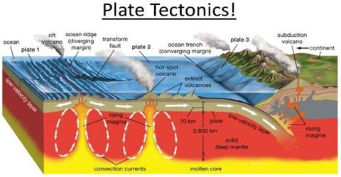


The crust is made up of segment called plates, which are of various sizes, Large and small plates. pacific, N. American, Nazca, S. American, Africa, Indian, Antarctica plates.
TYPES OF PLATE BOUNDARIES
Plate boundaries can be categorized in three fundamental types:
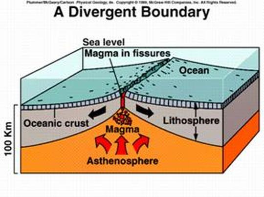
(a) Divergent boundaries - This occurs when plates separate and move in opposite directions, allowing new lithosphere to form from upwelling magma. This either occurs at mid-ocean ridges (the so-called seafloor spreading) or at rifted continental margins.
- The space created can also fill with new crustal material sourced from molten magma that forms below. Divergent boundaries can form within continents but will eventually open up and become ocean basins.
i) On land
Divergent boundaries within continents initially produce rifts, which produce rift valleys.
ii) Under the sea
The most active divergent plate boundaries are between oceanic plates and are often called mid-oceanic ridges.
(b) Convergent boundaries - This occurs where the plates move towards each other. One plate either sinks beneath the other along a subduction zone or plates collide because neither can be subducted.
- Subduction zones occur when one or both of the tectonic plates are composed of oceanic crust. The denser plate is subducted underneath the less dense plate. The plate being forced under is eventually melted and destroyed.
i) Where oceanic crust meets ocean crust
Island arcs and oceanic trenches occur when both of the plates are made of oceanic crust. Zones of active seafloor spreading can also occur behind the island arc, known as back-arc basins. These are often associated with submarine volcanoes.
ii) Where oceanic crust meets continental crust
The denser oceanic plate is subducted, often forming a mountain range on the continent. The Andes is an example of this type of collision.
iii) Where continental crust meets continental crust
Both continental crusts are too light to subduct so a continent-continent collision occurs, creating especially large mountain ranges. The most spectacular example of this is the Himalayas.
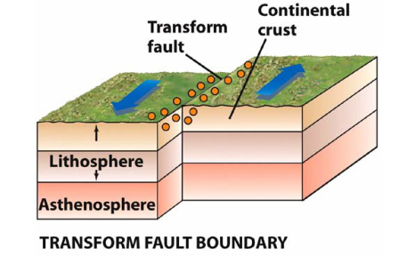
(c) Transform fault boundaries (Neutral / trans current boundary) - This occurs when plates move horizontally past each other.
- Natural or human-made structures that cross a transform boundary are offset-split into pieces and carried in opposite directions. Rocks that line the boundary are pulverized as the plates grind along, creating a linear fault valley or undersea canyon. Earthquakes are common along these faults. In contrast to convergent and divergent boundaries, crust is cracked and broken at transform margins, but is not created or destroyed.
Based on the three types of plate boundaries, a global network of approximately twelve major plates of irregular shape and size cover the Earth's crust. Where one type of plate boundary is terminated it is transformed into a boundary of a different type.
CAUSES OF MOVEMENTS
i) Convectional current
During mantle convection some materials rise due to the influence of radioactive heat generation and later moves laterally below the lithosphere. The lateral movements drag the lithosphere leading to the plate tectonic movements. On cooling the materials sink down to the lower level of the mantle where they melt again due to the constant motion of the plates
ii) Upwelling of magma in the lines of weakness for example in the mid-oceanic ridges where by the magma is pushed out of the surface through the weak lines of the crust, in order to form a new crust. This may result to the cause of movements
iii) Isostatic adjustment
May cause slight movement when trying to create balance.
iv) Cooling and heating of the crustal rocks
Expansion and contraction of rocks. The heat in the interior of the earth (mantle) causes rocks inside to expand and when the heat reduces, the rocks cool. This process causes the rocks to crack hence leads to the disturbance of the crust and causes movements.
EFFECTS OF PLATE MOVEMENT
Changes on the plate boundaries which are lines of weakness and on these boundaries, major landforms of the earth’s surface are going to be formed.
a) Diverging plates
I) Oceanic
- Mid oceanic ridges
- Oceanic Islands
- Rifts e.g. Red sea
II) Continental
- Volcanic mountain
- Block mountains
- Rift valley
b) Convergent plate boundary - Collision may lead to subduction and uplift.
i) Oceanic - oceanic trends (Marianna trenches, Japan trenches)
ii) Oceanic and continental-Volcanic mountains on the coastal boundaries and also result into trenches.
iii) (Continental)- Formation of Fold Mountains. Himalayas ( Indian and Russian plate formed)
c) Neutral / Trans current boundary - There is neither uplift nor seduction. There is lateral displacement of the plates. N. America, San Francisco - San Andrea’s faults displacement of features of about 1000 km.
The plate tectonic areas are areas of instabilities which results to earth quake, volcanoes.

The theory of plate tectonic can help to explain almost all of the landforms on the surface of the earth.
i. Deep sea Trenches: A sea trench is a long deep valley along an ocean floor.they form along a convergent destructive term of depth.the Mariana in the western Pacific with a depth of more than 36000 ft.
ii) Mid Oceanic Ridge: It refer to a giant undersea mountain range made up mostly basalt.It may be more than 80000 km long and 1500 to 2500 km wide and it may rise to 2.3 km above the ocean floor.The feature is associated with a divergent plate boundary.As plate diverge, magma rises repeated and eventually cools to form the mid oceanic ridge.
Example: East Pacific as Nazea and Pacific diverges North Atlantic as North America diverges the Eurasian.
iii) Island Arcs:Sometimes basalt eruption along the ridge or near may build up volcanoes that protrude above sea level to become Oceanic Island.They may vary in size. Example: Iceland,Japan, Hawaiian is lands, Mauna Loa, Easter Islands near the East Pacific ridge, west Indies.
iv) Magmatic Arc:It refers to island arcs at sea and belts of igneous activity on the edges of continents such as batholiths in mountain belts. Example:Aleutian Island.cascade volcanoes of the pacific North West,along Andes.
v) Mountain Belts:At a convergent collision boundary,the sea floor is denser and will be subducted making the ocean thinner and narrower hence collision of the continents.Eventually the oceanic lithosphere breaks off leaving the continental crumple to form mountain ranges.
The thick sequences of sedimentary rocks that had built upon both continental margins are intensively.Example The Himalayas as India collided lided, Alps as African and Europe, Atlas in Northern Africa.In addition to that at a convergent destructive boundary,young mountain like the Andes form due to the folding of the young sediments.
vi) Rifting and associated features:At a passive divergent plate boundary ,the continental crust is stretched and thinned producing faulty landforms like the great East Africa Rift Valley.The faults may be path associated volcanic landforms. This may explain the volcanic landforms in the rifted areas of East Africa.
Due to thermal expansion emanating from rising mantle plume, it causes uplift of landscape.
vii) New Oceanic Crust:This is associated with a divergent plate margin where the would be gap is filled with the up welled magma to form a new oceanic crust.


TOPIC 1: STRUCTURE OF THE EARTH
The Meaning of Earth
- Earth is the planet on which we live, the world
- Earth is the planet third in order from the sun, having an equatorial diameter of 7926 miles (12,755 km) and a polar diameter of 7900 miles (12,714 km), a mean distance from the sun of 92.9 million miles (149.6 million km), and a period of revolution of 365.26 days, and having one satellite.
- The earth is the land surface on which we live and move about.

Earth
Structure of Earth
- The shape of the earth is an oblate spheroid, because it is slightly flattened at the poles and bulging at the equator.
- The earth is a system which is composed of outer and inner zones. The outer zones of the earth include the atmosphere, the hydrosphere and the barysphere. The inner zones of the earth include the crust, mantle and the core.

The Structure of the Earth showing Inner Zone and Outer Zone
CONCENTRIC ZONE OF THE EARTH
The inner zones of the earth constitute the internal structure of the earth. The inner zone / internal structure of the earth consists of three zones or layers which are:
1. Crust
2. Mantle
3. Core
The boundaries between these layers were discovered by seismographs which showed the way vibrations bounced off the layers during earthquakes. Between the Earth's crust and the mantle is a boundary called the moho. It was the first discovery of a major change in the Earth's structure as one goes deeper.
1. CRUST
Is the outermost and thinnest zone of the earth which found between 8 – 50 km or 5 – 30 miles. It is known as Lithospere, It is largely composed of igneous rocks. Other types of rocks also exist as a result of changes on the earth’s surface. The rocks are crystalline, hard and brittle. Bacause of being brittle they tend to break when subjected to stress or forces especially the compressional forces. The crust also consist of two layers are sial and sima layers.
a) Sial
Is the outer layer of the crust which rich in silica and Aluminium minerals. The sial for the basis of the continent. The presence of silica and aluminium minerals collectively form SIAL layer.
a) Sima
Is the layer which found beneath the sial. It is the inner layer of the crust which separated from sial layer by the zone called Conrad discontinuity line. The sima layer is composed by silica and magnesium. It forms the basis of ocean floor.
Note: Sial and sima layer together forms the crust.
2. MANTLE
Mesosphere or mantle which found between the crust and core. It lies beneath the crust. It separated from the crust by the zone of separation called Mohorovic discontinuity or moho. It extends downward to about 2900 km (1800 miles) where the temperatures may reach about 50000c. It consist of pale green minerals called Olivine (Ferromagnesium silicate) in form of ultra basic rock.It consists of lower and upper mantle. The upper mantle is rigid and crust to form a large layer called lithosphere.
The lower mantle is less rigid and forms the moltern layer within the earth’s interior called asthenosphere. Asthenosphere is the molten layer layer which responsible for the balancing movement of the earth’s material called isostatic readjustment. Asthenosphere has been investigated is found between 100 to 200 km below the upper surface.
3. CORE
The core is the innermost zone of the internal structure of the earth. It is also called barysphere or centrosphere. It has diameter of about 6900 km (4300 miles) density of about. The core is also classified into two parts i.e. the outer and inner core. It separated from the mantle by zone of separation called Gutenberg discontinuity.
1. The Outer Core
It is liquid in nature due to high temperature of up to 37000c, and consist of nickel and iron (NIFE) . It is estimated to be 2100 km with density of about 10.5 gms/cc.
2. The Inner Core is thought to be solid in nature because of high pressure exerted from different parts toward the center - It composed mainly by iron. It has diameter of about 2600 – 2700km. (1600 – 1700 miles)

EXTERNAL STRUCTURE OF THE EARTH
External structure of the earth consists of four main layers’. These are Atmosphere, Hydrosphere, Lithosphere / Land mass Biosphere, Biosphere
1. THE ATMOSPHERE
Is the thin layer of gases held on the earth by gravitation’ attraction. It composed by abiotic (nonliving matter) and biotic living organism. Non-living matter found in the atmosphere includes mixture of gases, water vapor and dust particles. The living organism include the smallest or microscopic organisms like bacteria
COMPOSITION OF ATMOSPHERE
Atmosphere is the outer zone or external structure of the earth composed by Abiotic and Biotic components.
1. Abiotic Components of Atmosphere. The abiotic components of the atmosphere include the following. Mixture of various gases These include Nitrogen (78%), oxygen (21%), argon (0.009%) and carbon dioxide (0.03%). Other gases include neon, helium, Krypton, xenon and other which are present in minite (small proportion) percentage. Water vapor Is the colorless and odorless (smell less) gas in the form of water which makes up a perfect mixture with other gases.
The degree to which water vapor is present in the atmosphere is called humidity. Humidity is very important to weather as condensed to form clouds and fog. Excess water vapor brings about precipitation in form of rain, hail, snow and sleet. Water vapor is capable of absorbing heat which penetrates into the atmosphere in the form of radiant energy from the sun to the earth. It is also act as a blanket which prevents the rapid escape of heat from the earth’s surface and therefore maintain heat budget. Dust particles.
The Dust Particles may Exposed to the Atmosphere Naturally or Artificially
a) Natural dust particles are those caused by natural phenomena like winds and volcanic eruptions.
b) Artificial dust particles are those derived from industrial pollutions such as soot and ashes. It includes the particles caused by other man’s activities like construction, mining and farming activities.
The function of dust particles serve as a nuclear or center around which water vapor condenses to produce clouds.
2. Biota components of atmosphere includes bacteria etc
STRUCTURE OF ATMOSPHERE
According to the temperature changes, atmosphere divided into two zones. These are Homosphere and Heterosphere
HOMOSPHERE
Homosphere is the layer which found between 0 – 80km above the sea level. This is the lowest part of the atmosphere which composed of uniform composition gas of uniform composition of gases and temperature. Homosphere consists of three layers, namely:
i) Troposphere
This layer extends by 0 – 15km above the sea level. Troposphere is the first layer of homosphere located nearest to the earth. It contains water vapor, gases and dust particles. It is the layer of atmosphere which support life on the earth due to the presence of plenty oxygen gas. All processes of rainfall formation take place in this layer and the temperature decreases as the altitude increases at the rate of per every 100 meters or per every 1000 meters.
Note: This situation where by temperature decreases as altitude increases is called lapse rate and because it occur near to the ground is called environmental Lapse rate. The upper limit of Troposphere which separates it to the next later is called Tropopause. Tropopause makes the upper limit of troposphere to the next layer called stratosphere.
ii) Stratosphere
Stratosphere exists between 15 – 48 km above the sea level. This is the second layer of homosphere which lies above the tropopause. It is also composed of water vapor, dust particles and various gases. It is the layer of atmosphere which characterized by high concentration of Ozonic gases. This gases form Ozone layer which found particularly at 20 –35 km in the stratosphere.
The Ozonosphere or ozone layer is the layer which form a shield or cover that prevent the earth’s surface from destroying by the sun rays. It prevents the direct incoming of harmful rays from the sun to fall direct on the earth’s surface. The temperature remains unchanged about between 20 – 35 km from the earth’s surface. Then temperature increases with height to about at the upper limit of stratosphere called stratopause. The increase in temperature with height is referred to as temperature invasion.
iii) Mesosphere
This layer extends between 48-80 kilometers above the sea level. Mesosphere is the third part of the homosphere where temperature decreases as the altitude increases. It separated from the stratosphere by the zone of separation called stratopause. The upper limit of mesosphere is called mesopause. Mesopause record minimum temperature of this zone that may fall to making this zone to be coldest. It is at this zone where strong upper air streams of wind like jet streams are experienced.
HETEROSPHERE
Is the second layer of atmosphere which extends from 80km towards the interplanetary space. Heterosphere divided into two layers which include Thermosphere and Exosphere
i) Thermosphere
Is the lower part of heterosphere where temperature increases as the altitude increases from i.e. temperature invasion. This is because there is no water vapor or dust particle in this zoneIonosphere consists of some ions which influence radio waves. This is because, ionosphere is electrically charged with free electrons that allow the passage of radio waves, television waves and telephone or mobile phone waves
ii) Exosphere
Is the part of heterosphere which found above the thermosphere. It has high temperature through it has little significance as it has not been greatly researched.
Note: Within the heterosphere, there is also a scientific significant layer called ionosphere. Ionosphere consists of some ions which influence radio waves. This is because, ionosphere is electrically charged with free electrons that allow the passage of radio waves, television waves and telephone or mobile phone waves.

Function of Atmosphere
1. Insulation Atmosphere is an insulator, it acts as a shield or blanket and therefore regulates temperature during the night and during the winter.
2. Filtration. The atmosphere is the filter, it filters solar insulation and percent ultra violet rays of certain length due to the presence of ozone layer in the stratosphere.
3. Scientific function. Atmosphere is the scientific field, it is the field through which the scientific experiments and observation carried out. Example ionosphere layer of atmosphere reflects some electromagnetic waves and ration signals back to the earth.
4. It supports much on hydrological cycle. The surface water, evaporation, condensation and precipitation formation take place in the atmosphere.
5. It support life some gases particularly oxygen is important for living organisms. Air has weight which contributes to the occurrence of atmospheric pressure variations without which breathing would be impossible. Wind movement and direction that balances temperature, humidity and precipitation also result from pressure variations.
2. THE HYDROSPHERE
Is the layer of water bodies of the earth including all oceans, rivers, precipitation and underground water. It is estimated that 75% of the Earth’s surface is covered by water bodies.
3. THE LITHOSPHERE / LAND MASS
Is the whole solid body of the earth with various landforms such as mountains, valleys and plateaus. The lithosphere is also known as the crust. It includes all land masses. The major land mass is called continent and the minor land mass is called islands.
4. THE BIOSPHERE
Biosphere is the complex zone which comprises all living things. It includes a lower level of atmosphere and the upper level of lithosphere and hydrosphere. Biosphere receives substantial supply of energy from the sun which gives it condition necessary for life and does not occur in any part of the solar system. The living organisms that inhibit biosphere interact with each other and their environment. The sum of all these interaction components is called the ecological system or ecosystem. Biosphere comprises all living organism both macro and micro organisms living in water bodies, soils and on air.
MATERIALS OF THE EARTH'S CRUST
The earth’s crust is composed of different materials ranging from elements, minerals and rocks. These materials differ in their physical and chemical composition.
Elements
They refer to the smallest particles of matter which can not be split into different forms by any means. Examples of elements are magnesium, potassium, sodium, iron, aluminum and silicon.
Minerals
They are naturally occurring substances which have definite shape, colour and resistance formed due to combination of different elements. They are formed as a result of the combination of two or more elements. Some single elements like gold, silver and diamond may occur as minerals. Mineral Element Quartz Silicon and oxygen Feldspar Potassium, sodium, calcium and aluminum
ROCK OF THE EARTH’S CRUST
A rock is an aggregate of minerals in a solid state. On the other hand the term rock can include substances like clays, shells, sandstones and corals. Rocks which contain metallic compounds are called ores.
Types of Rocks on the Earth’s Crust
Rocks of the Earth’s crust can be classified according to their mode of formation and chemical composition. According to the mode of formation rocks can be classified as classified as igneous, sedimentary and metamorphic.
1. IGNEOUS ROCKS
Are rocks that formed when molten rock cools and solidifies within or outside the earth’s crust. The origin of igneous rocks is inside the earth where they are under great pressure. Igneous rocks do not occur in layers and they don‘t contain fossils. Igneous rocks solidify either within the earth‘s crust and form intrusive features or outside the earth‘s surface and form extrusive features.
Igneous rocks are formed when the molten magma is forced out from the upper mantle to the earth‘s surface, where it cools and solidifies due to low temperature. Crystals form on cooling and the rocks are called crystalline rocks. There are two main types of igneous rocks:
1. Plutonic: these have solidified deep in the crust and they are seen on the surface only after being exposed by prolonged erosion.
2. Volcanic: these have been poured on the earth‘s surface where they are called lavas.
Characteristics of Igneous Rocks
1. Igneous rocks reflect light.
2. They are not found in layers.
3. They do not contain fossils.
4. They are crystalline rocks.
5. They are formed through cooling and solidification of magma.
6. They can undergo metamorphic and weathering processes.
7. They contain different minerals like iron, magnesium etc.
In Tanzania igneous rocks are found in Dodoma, Iringa and in the shores of Lake Victoria (Mwanza). The main examples are granite, gabbro, basalt and diorite. Some are found in Kilimanjaro and Rungwe (Mbeya) such as basalt, pumice, diorite, gabbro, syenite and peridotite rocks.
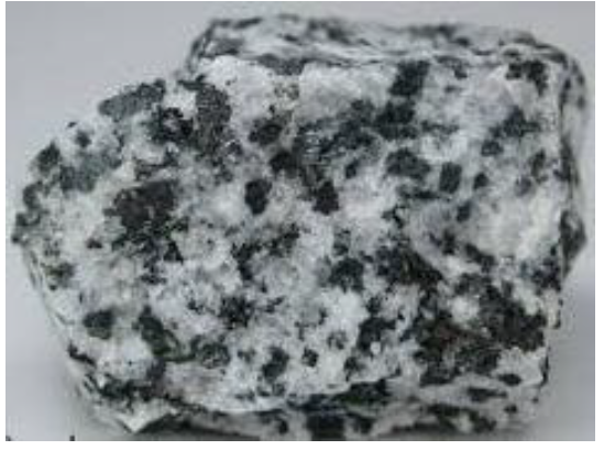
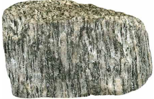
Granite
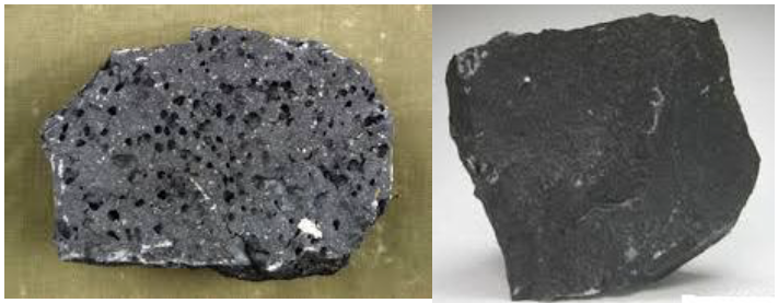
Basalt rocks
2. SEDIMENTARY ROCKS
Sedimentary rocks are rocks formed through weathering processes when sediments are accumulated, compacted and cemented together. The sediments are compacted by compression to form sedimentary rocks. Sedimentary rocks are found in layers; they contain fossils and are very soft. These are weathered particles formed through deposition and lithification processes
Characteristics of Sedimentary Rocks
1. They are formed when particles or sediments are accumulated, compacted and cemented together.
2. They contain fossils.
3. They are found in layers (strata).
4. They do not reflect light.
5. They are non-crystalline rocks.
6. They can undergo metamorphic process.
Types of Sedimentary Rocks
1. Mechanically-Formed Sedimentary Rocks. These are formed through weathering process. When weathering agents erode and deposit rock particles, they are accumulated, compacted and cemented together to form sedimentary rocks. Examples of mechanically formed sedimentary rocks are clays, gravels and alluviums (all deposited by water), moraines, boulder clay and gravels (deposited by ice) and loess (deposited by wind); sandstones and shale.
Sandstone
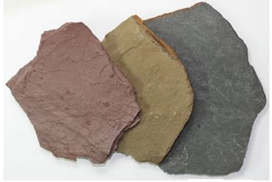
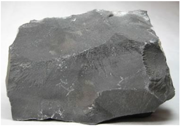
Shale: Shale occurs in a wide range of colours that include: red, brown, green, grey, and black.
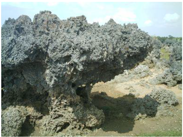
2. Chemically-Formed Sedimentary Rocks. These are formed through chemical precipitation process. They include carbonate (as it is in stalactite and stalagmite), sulphate, chloride, etc. The main examples are gypsum, rock salt, lignite, dolomite, flint, borax, limonite, haematite, etc.
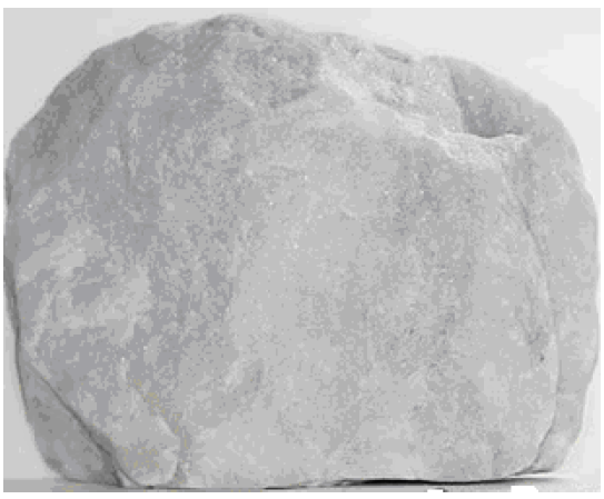
Dolomite
3. Organically-Formed Sedimentary Rocks. These are formed through mineralization process of decaying and decomposition of dead organisms such as animals and plants. The remains of living organisms are accumulated, compacted and cemented together to form these sedimentary rocks. The main examples are chalk (limestone) and coral (formed from animals), and peat, coal and lignite (formed from plants).
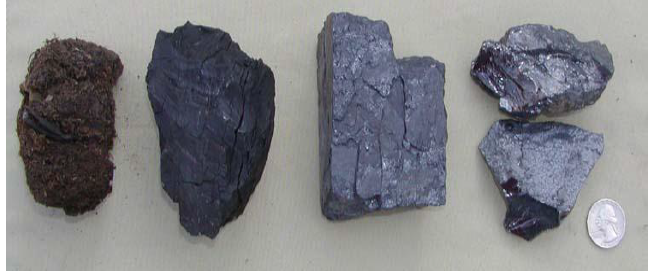
Lignite rocks
Limestone
Chalk
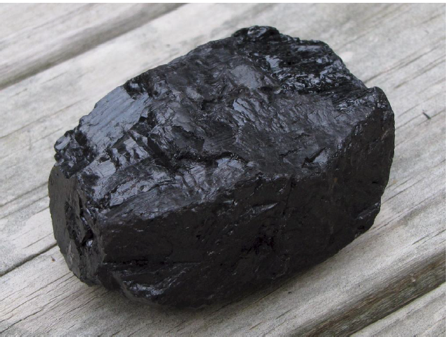
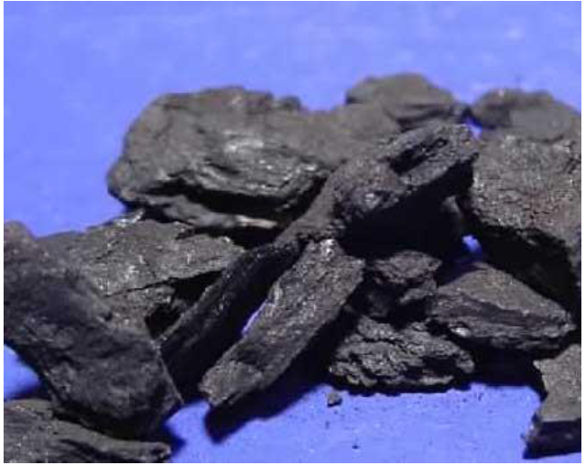
Coal
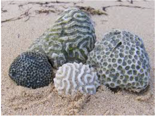
Coral rocks
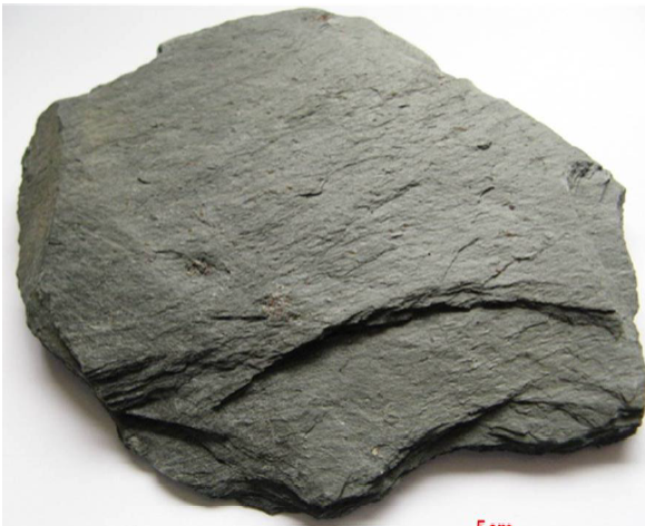
3. METAMORPHIC ROCKS
These are rocks which have changed from one type of rock to another due to the contact of heat, pressure or both. This process is referred to as metamorphism. Any rock can be changed into a metamorphic rock. Examples of metamorphic rocks are slate, marble and granite.
There are Three Kinds of Metamorphism
1. Dynamic metamorphism. This is influenced by pressure of the earth’s crust. Examples; Shale to Schist, Clay to Slate, Granite to Gneiss
2. Thermal or contact metamorphism. This is caused by intense heat. This can take place when the rock comes into contact with hot molten material like magma or lava. Examples: Lime stone to Marble, Sand stone to Quartzite
3. Thermal dynamic metamorphism This is the process that takes place as a result of a combination of heat and pressure. It is when the existing rocks are subjected to both pressure and heat to change their shape and appearance. Example Coal to Graphite
Characteristics of Metamorphic Rocks
1. They are very hard due to prolonged action of heat and pressure.
2. These rocks can change to another to another type of rocks.
3. They can undergo weathering process.
Slate
Gneiss
ROCK CYCLE
Rock cycle is a relationship in which rocks tend to change from one type of rock to another. This is the cycle in which rocks tend to change from one type to another. For instance igneous rocks may change to metamorphic rocks or sedimentary rocks; sedimentary rocks to metamorphic or igneous rocks, etc.
Necessary Conditions for Rock Cycle to Take Place or Process of Rock Cycle
1. First, the molten rocks erupt from the interior of the earth and then cool and solidify to formigneous rocks.
2. Secondly, the igneous rocks are subjected to denudation process to form sedimentary rocks.
3. Third, either igneous or sedimentary rocks undergo metamorphism, due to prolonged heat and pressure, to form metamorphic rocks.
4. Fourth, metamorphic or igneous rocks can undergo weathering process through erosion and transportation of sediments which are further deposited in layers in the ocean or lake floors where they are cemented and consolidated to form sedimentary rocks and vice versa.
5. Fifth, metamorphic or sedimentary rocks can be subjected to heat and pressure where melting take place and later cooling, due to low temperature, to form igneous rocks.

Rock Circle
Simplified Geological Time Scale
The geological time scale is a chart for dating the history of the earth including rock span. It tries to explain the age of rocks as far back as 600 million years ago.
The simplified geological time scale
Era
Period
Years in millions before present
Major geological events in Africa
Man and animals
Cenozoic
Quaternary
1
Glaciation of East Africa mountains.Formation of river terraces and raised beaches.
Age of man
Tertiary
163
Formation of the Atlas mountains. Lava flows in Ethiopia.
Age of mammals.
Mesozoic
Cretaceous
135
Deposition of marine sediments in the Sahara and Southern Nigeria. Formation of Enugu coalfield.
Age of reptiles
Jurassic
180
Break-up of Gondwanaland and Marine invasion of East Africa coastlands and separation of Malagasy Island from mainland.
Triassic
230
Drakensburg lava and formation of upper Karro beds. Volcanic activity in West Africa.
Paleozoic
Permian
280
Formation of lower Karro beds. Formation of rich coal deposits in Tanzania and South Africa. Ice age in central and South Africa.
Age of amphibians
Carboniferous
345
Cape fold formed.
Devonian
405
Marine invasion of Libya, the Sahara and Western Sudan. Continental basins formed by crustal warping
Silurian
425
Continental sedimentation in Zaire basin,Tanzania and South Africa, followed by intensive folding.
Ordovician
500
Extensive deposition of sediments.Formation of sandstones in Guinea, Mali, Volta basin and North West Ethiopia
Age of marine invertebrates
Cambrian
600
Marine invasion of Western Sahara and Kalahari basin.
Proterozoic
Pre Cambrian or Archarean
Glaciations of Africa South of Equator.Extensive metamorphism of oldest known fossilized, unicellular algae formed in Swaziland and Mali.
Algae
The Importance of Rocks
1. Rocks are very important in the formation of soils which can be used for agricultural production.
2. Rocks are used for building purposes: some rocks such as limestone, sandstone, gravels and sand are used for building houses, construction of roads, etc.
3. Some rocks are used as sources of energy or fuel such as coal and petroleum (mineral oil).
4. Limestone is widely used for cement manufacturing. In Tanzania, cement is produced at Tanga, Mbeya and Wazo Hill.
5. Salt extraction: salt usually originate from rock accruing strata, for instance, in Tunisia and Morocco there are large deposits of salt.
6. Manufacture of chemicals: some rocks contain nitrate or phosphate, while others have potash. This kind of rocks can be used for making dyes, fertilizers and medicines.
7. Mineral deposits: mineral ores occur in veins of some rocks such as igneous rocks. The minerals are formed when the magma coos down. Valuable minerals extracted from rocks include gold, lead, tin, silver, diamond, copper, zinc, aluminium, calcium and manganese.
8. Some rocks are so impressive such that they attract tourist to come and view them. In so doing, the country earns a lot of foreign exchange.
9. Some rocks are used for decoration of houses as ornaments or they are grinded to produce powder which is used for decoration.
CLICK HERE TO CONTINUE WITH TOPIC....