

GLOBE Is the model of the earth
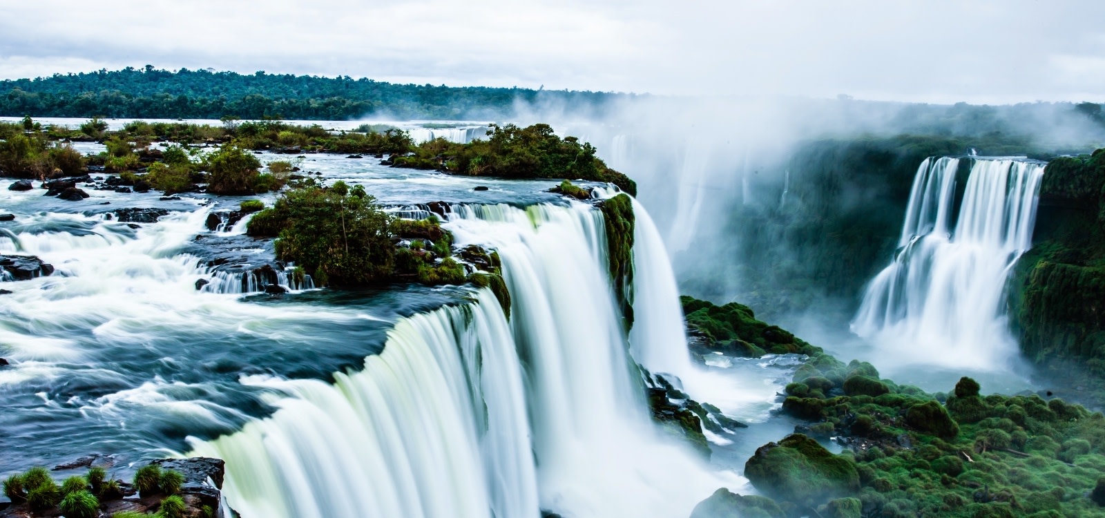
Earth Is ball of rock partly covered by water, land, air and living organism
Origin of the earth (cosmological theories)
1) Creation theory – This theory is also called biblical or religious theory. Creation theory maintains that in the beginning God created the heaven and the earth and God said let there be light in the expense of the sky to separate sky from night and let them serve as signs to mark seasons, days, and the years and let there be lights in the expenses of the sky to give light to the earth.
To meet all these god created two great lights, the greater light ( the sun) to govern the day and the lesser light ( the moon) to govern the night and also make the stars god set them in the expense of the sky to give light on the earth, to govern the day, the night and to separate light from darkness. This text is found in genesis, the book of the bible in the 1st chapter.
ATMOSPHERE
The Outer Part of the Earth
1. The atmosphere: Is a thin layer of air /gases which envelopes the earth. It extended to the surface to about 1000km above atmosphere is held to the earth by force of gravity.
This atmosphere is medium of weather and climate.
Vertical structure of the atmosphere
Two major divisions i) Homosphere (below)
ii) Heterosphere (beyond)
I.) HOMOSPHERE
This is the lower part of the atmosphere runs from 0 -80km
Above the surface the hemisphere is divided into 3major or parts.
a) Troposphere -Lower
b) Stratosphere – Medium
c) Mesosphere – Upper
a)TROPOSPHERE
– This is the lowest part of the atmosphere.
– Ranges from 0-15 km above the ground.
– It is characterized by frequency weather changes.
– And it is in this part where meteorologists concentrate.
– There is a lapse rate of temperate where by temperature decrease with increase in altitude(environmental lapse rate).
– This layer has got the largest content of vapour and solid particles.
– The air is mixed up.
– The upper limit is called tropopause.
– The tropopause is higher near the equator and is lower at the poles
b) STRATOSPHERE
-This is the intermediate layer between troposphere and mesosphere
-It extends from 15-50 above the earth surface
-The air is not mixed up; it is in layers (the ozone layer is found here)
-Temperature remains constant or increases with altitude (temperature inversion this is due to the ozone layer which observes ultra violet rays from the sun which are harmful).
-Pressure decreases with altitude because there is less air
-Less water vapour
-The upper limit is stratopause.
c) MESOSPHERE
It is the layer above the stratosphere Range from 50-80 km above the earth surface
There is temperature decrease with increase in height or altitude.
This is where the temperature are lowest may go lower to -90C and the regions has the strongest wind nearly 3000km

Homosphere;
1.) Troposphere.
2.) Stratosphere.
3.) Mesosphere.
Heterosphere:
1.) Thermosphere
2.) Exosphere.
The constituents /composition of the atmosphere
All states of matter are found in the atmosphere.
1. Gases
2. Liquid
3. Solids
1) GASES
NAME PERCENTAGE IMPORTANCE
i) Nitrogen 78.09% needed for plant growth.
ii) Oxygen 20.95% respiration for human and plant.
iii) Argon 0.93%
iv) Carbon dioxide 0.03% used by plant for photosynthesis
v) Ozone 0.00006% absorbs incoming ultra violent
vi) Hydrogen 0.0005% used in filling balloons
2) LIQUIDS
Water vapour-The liquid form of in terms of gaseous state 3-4% which various with latitude and altitude
– The volume of vapour varies with latitude and altitude
– Lower altitude is around the equator
– Source of vapour at the atmosphere is the hydrological cycle ( cycle)
SOURCES AND IMPORTANT OF WATER (H2O) VAPOUR
i) Source of clouds and precipitation
ii) Reflects /absorbs incoming radiations
iii) Keeps global temperature constant
iv) Provides majority of natural ‘green house effect’
v) Essential for life on earth
vi) Can be stored as ice /snow
3) SOLIDS.
Small solid practices which are also found in the atmosphere E.g Dust,Ashes.
Source of solid particles in the atmosphere
1. Wind- source of dust in the atmosphere
2. Volcanic eruptions – Solid particles are through at a great high to the atmosphere and some remain there for years
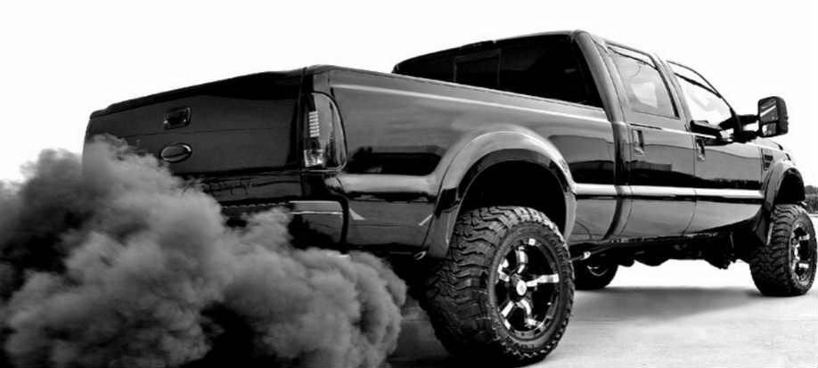
3. Industrial pollution – (e.g. Twiga cement) the smoke is released to the air which contains some solid particles.
4. Bomb (explosion)- During wars
5. Burning of trees rubbish producing ‘soot ‘
6. Combustion – Smoke from car engines
Uses
1) Scatter of incoming radiation
2) Form condensation nuclei information of rainfall

NOTE
Concentrations of the atmospheric component are below 30km above the surface (99 of these components).
– Carbon dioxide is not constant component at the atmosphere, increase in altitude with decrease in carbon dioxide. It is more in low latitude and decreases towards the pole (not evenly distributed)
Effects of air pollution
1. Cause diseases such as air borne diseases [asthma].
2. Global warming, It is a recent phenomenon caused by human activities.
– It is a gradual increase in temperature of the world. This was discovered /started during the 19thcentury during the industrial revolution period.
– Human activities result into green house gases.
Major Green house gases
Gas
1. Water vapour
2. Co2
3. Methane CH4
4. Nitrous Oxide
5. CFCS
SOURCES
1. Evaporation from the sea/ocean, evapotranspiration from land
2. Burning of fossils, fuel (powerhouses, industry, and transport) burning rainforests, and respiration.

3. Decaying vegetation (peat and swamps), farming (fermenting animal dung& rice- growing), and sewage disposal and landfill sites.
4. Vehicle exhausts, fertilizer, nylon manufacture, power stations.
5. Refrigerators, aerosols sprays, solvents and foams.
How do green houses gases cause global warming.
‘Green houses effects’
(Importance of ozone layer, it absolves the dangerous ultra-violet rays/radiations and prevent them to enter the surfaces). Destruction of the ozone layer leads to more penetration of the ultra-violet rays hence increase in temperature.
EFFECTS OF GLOBAL WARMING
1. Melting of ice. (Ice masses) e.g. ice cap on the Kilimanjaro Mountain.
2. Rising of the sea level. – Submergence
3. Deaths – May lead to disappearing of some species due to higher temperature and deaths of humans.
4. Diseases – Skin cancer.
5. Discomfort ability
6. Prevalence of droughts conditions in various parts of the world affecting food production.
7. Cold areas have become warm such that tropical areas are grown successfully
8. Leads to migration of people and animals due to floods and droughts.
9. Decline in production has contributed to increase in poverty and prevalence of famine.
CONTROL MEASURES OF GLOBAL WARMING.
Anthropogenic (mainly caused) for Human activities which causes global warming.
I. CONTROL POLLUTION
-Afforestation and Reforestation – The plants will absorb the CO2

-Alternative sources of energy which is less pollutant. (Solar, wind and etc)

-Control human behavior (e.g. the uses of bomb and activities industrial pollution).
-Creating international laws which control pollution (strict).
-Environmental education should be provided
-Recycling of wastes should be encouraged rather than burning.
Global climatic changes
i) EL Niño – Over rainfall
ii) Changes pattern of agricultural belts (desertification).
SHAPE OF THE EARTH
-Misconception of the shape of the earth.
-The earth thought to be flat.
Truth – The earth is round.
-Sphere like – Spherical in shape. But not the perfect sphere why? We look at dimensions.
-Equatorial diameter – Is longer than polar diameter (12,762 kms)
-Polar diameter – Is shorter than equatorial diameter (12,722 kms)
-Equatorial circumference – Is longer than polar circumference (40085 kms)
-Polar circumference – Is shorter than equatorial circumference (39,955kms)
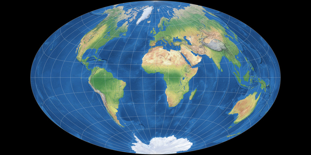
The earth bulges at the equator and slightly flattered at the poles. This shape is called GEOID.
Proofs of the earth’s shape
1) AERIAL PHOTOGRAPHS – Photographs taken by satellite at great distances from the earth all shows that the earth’s surface is curved. They show the curvature of the earth.

2) LUNAR ECLIPSE – When there is an eclipse of the moon the shadows of the earth which is thrown on the moon is always round. Only a sphere can cast a shadow which always circular. The position of the sun, moon and earth, in an eclipse of the moon are;

3) CIRCUMNAVIGATION OF THE EARTH – If you travel across the world along a straight path in a fast flying plane without stopping anywhere, you would come back to the same place from where you started. This is called circumnavigation.
The fact is valid as the earth has shown circumnavigated for many times and finding the voyage ending to the original point.
For example; voyage made by the Portuguese navigator called Magellan between 1519 & 1522 proved that, the earth is round and not flat as the voyage ended to the point of origin (land, air, water).
4) SUNRISE AND SUNSET – The earth rotates from west to east through 3600 in 24 hrs. This means that people living east see the sun earlier than people living in the west.
If the earth could be flat all people over the earth would experience sunset and sunrise at the sometime. This provides a fact that the earth is spherical in shape.
The appearance of sunrise and sunset on the earth’s curved surface and what the appearance would be like if the earth’s surface us flat.
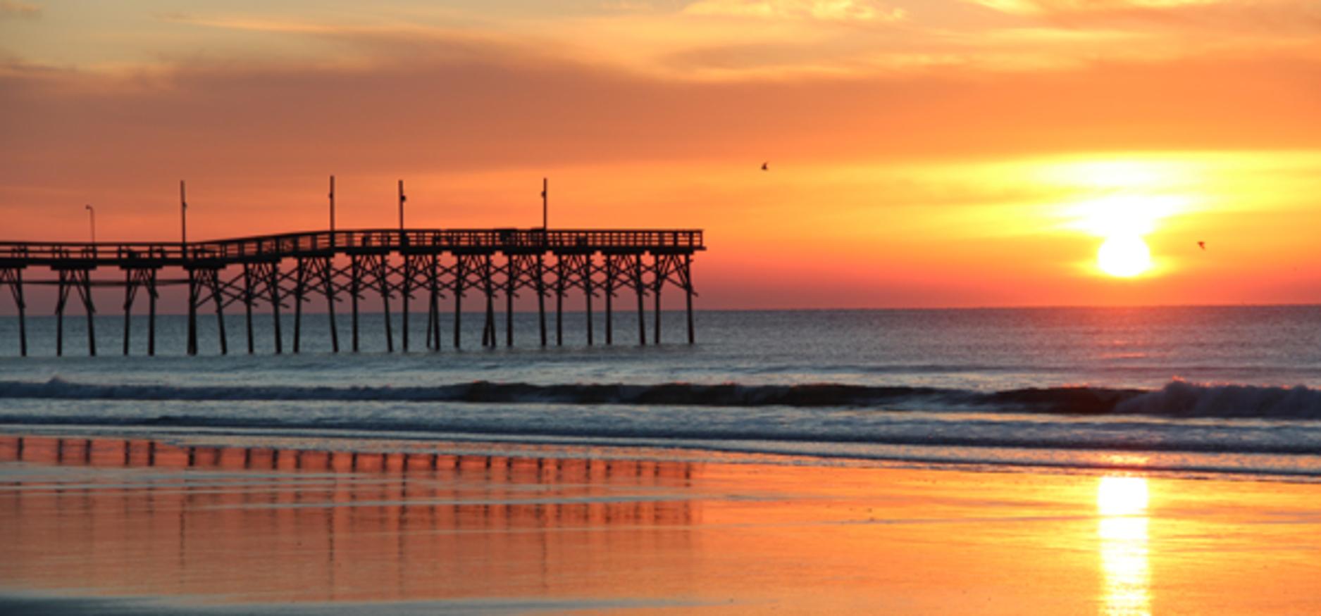
5) EARTH’S CURVED HORIZON – The earth’s horizon when seen from a ship, a plane, or a high cliff appears curved. The curved horizon widens as the observers altitude increases until it becomes circular.
If the earth were not spherical, there would be no circular horizon. The curvature of the horizon is influenced by the curvature of the earth’s surface.

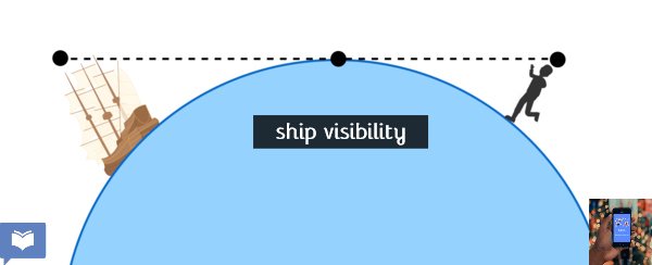
6 A SHIP’S VISIBILITY – When a ship is approaching the coast land from a distance at the sea smoke is first seen at the horizon. As it comes nearer, the most appears and finally the whole ship is seen, this gradually appearance of the ship provides a fact that the water body of sea overlie the surface which is not flat, but spherical in shape , hence the earth is spherical in shape. Also when 2 ships on the same line of observation are coming towards the observer while maintaining a considerable distance, the front ship will be seen before the ship at the back. If the earth’s surface were flat, both ships could be seen at the same time.
7 SURVEYING WITH POLES ON LEVEL GROUND – When the poles of the same length are driven into the level land, at equal intervals do not give a perfect level. The pole in the center usually projects above the level of the other poles at either end. This is caused by the curvature of the earth’s surface. If the earth were flat all the poles would lie on the line of sight.
8 THE CHANGING ALTITUDE OF THE SUN– In the morning and evening the sun observed to be at low level while at noon the sun obs erved to be at a high level. So long the sun is at constant position in the sky; this provides a clear clue that the earth planet is spherical in shape.
9) THE SHAPE OF OTHER HEAVENLY OBJECTS IN THE UNIVERSE BEING. CIRCULAR: – Other objects in universe like the sun, moon & planets are also observed round in the sky. So long the earth’s among of the heavily objects provides plausible evidence that it is also spherical in shape.
10) OBSERVATION OF THE POLAR STAR
As one goes polar wards the level of the polar star tends to increase and as one goes away from the polar the level of the polar star becomes lower and lower. If the earth’s surface were flat, the level of the polar star could be the same.
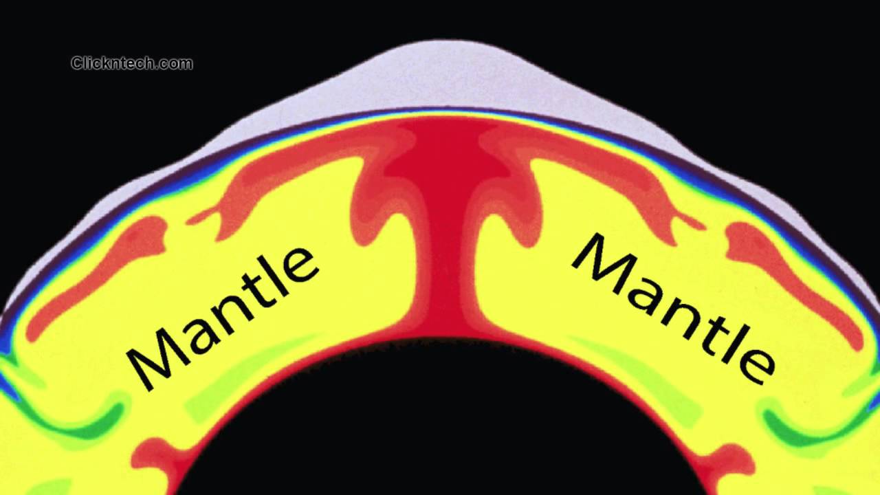
THE INTERNAL STRUCTURE OF THE EARTH & ITS COMPOSITION
-When the earth is divided into 2 hemispheres you will see concentric rings.
-A section through the centre of the earth reveals concentric rings of various depths.
These can be subdivided into 3 major zones/layers.
a. Crust
b. Mantle
c. Core
A. THE CRUST
-Is the outer most layer of the earth
-It is the thinnest layer. The depth varies from 8-50 km
Divisions
Has two parts : continental crust (sial)
: Oceanic crust (sima)
a) Continental crust
-Is made up of light rocks of density 2.5g /cm 3 of such rocks are granite sand stone +shale. It rests on continental platform
-Chemical composition mainly of SILICA (Silicon Dioxide) And ALUMINA (Aluminium Oxide) (AL2O3).These are collectively called SIAL
The rock is acidic in nature
b) Ocean crust
-Found beneath oceans.
-Made up of heavier rock density 2.8-3.0g/Cm 3
-Composition of SILICA (Silicon dioxide) and Magnesium (magnesium oxide) and iron
The rocks are collectively called SIMA
The rocks are basic in nature (basaltic)
Mohorovicic (Moho) discontinuity
This is a thin layer /transitional thin layer of about 6km thick which separates the crust from the mantle
This layer was named after the scientist who discovered it in 1909 by the name Mohorovicic .is in between the crust and mantle

B. THE MANTLE
The second major layer of the earth (intermediates layer) it is thicker /deeper than the crust about 2800 km deep.
It is also divided into two parts:
i) The upper mantle
ii) The lower mantle.
The upper mantle is rigid and combined with the crust to form LITHOSPHERE
-Density of mantle rock 3.3-5.7g/cm3
-Temperature is higher at this zone and they can reach 5000 because of pressure of overlying rocks. The rocks are in a semi –plastic (semi –molten nature of rocks) can allow slight movement
Composition of silica, magnesia (SIMA) and iron
Gutenberg discontinuity
Transitional layer which separates the mantle from the core
C.THE CORE
– The inner most layer of the earth
– It is the thickest layer
– The depth is about 3470km
– Divided into inner and outer core
– Made up of very heavy rocks density 10-16g/cm3
– Inner core is in solid states due to high pressure
– Outer core is in liquid states due to high temperature
– Composition iron & nickel (NIFE)
How do we know about the interior of the earth?
1.Drilling: Mohole project by Americans 270 km
Kuril – by Russian
This was a very expensive venture
2. Materials from the interior on the surface during volcanism (molten magma)
3. Study of seismic waves (seismologists) found in the interior of the earth
Relief feature on the earth’s crust
The surface of the earth has a continental crust and oceanic crust .Continental crust is not flat but has various relief features which is plain, hills, valleys, mountains etc
On the oceanic plat forms there are also relief feature examples of relief feature on the ocean floor are continental shelf, continental slope, deep ocean plains, ocean ridge, ocean trenches /ocean clips.
Note: The relief features can be explained by internal or external force / the relief features on the surface of the earth are a result of internal and external process
THE NATURE OF THE OCEAN FLOOR
The continental shelf: A gently sloping platform which extends from the continental landmasses terminating abruptly in a slope of steep gradient called the continental slope .The depth of the water covering the shelf is about 180m.
Some of the best fishing grounds are located in the water covering continental shelves because the shallowness of the water allows the sun rays to reach the shelf floor they by providing excellent condition for growth of plankton on which fish feed.
CONTINENTAL SLOPE:
A steep slope that extends from the edge of the shelf to the deep sea plain
DEEP SEA PLAINS
The wide gently undulating or fairly level surface which has a depth of between 2000m and 3000m.
OCEAN RIDGE
This takes the form of either a ridge or a plateau e.g. the mid Atlantic ridge and the albatross plateau which rise up from the deep sea plain and some of them rise above the surface to form oceanic islands (narrow)
OCEAN DEEP
A steep side trench plunging from the deep sea plane to depths of 10,000m or more.e.g.the Mariana trench 11km (11035m) of the island of Guam.
Ocean deeps occur on the edges of continents especially those bordered by Fold Mountains e.g. the Atacama trench of the coasts of Chile and Peru.
...
No comments:
Post a Comment